
Our Services
-
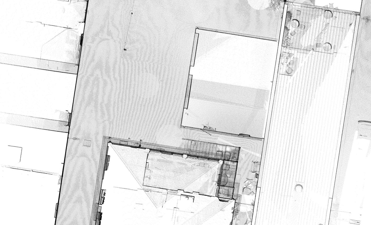
LiDAR
LiDAR (Light Detection & Ranging) is the ultimate technology for rapid collection of highly accurate and detailed spatial data.
Our USA built LiDAR sensor is capable of capturing precise data suitable for surveying, utility mapping and forestry applications.
With LIDAR, we can survey large areas much faster than traditional survey methods, and more accurately capture the true site conditions.
We produce a wide range of spatial data products from the resulting point cloud, tailored to your use case, workflows and various CAD, GIS and Survey packages.

-
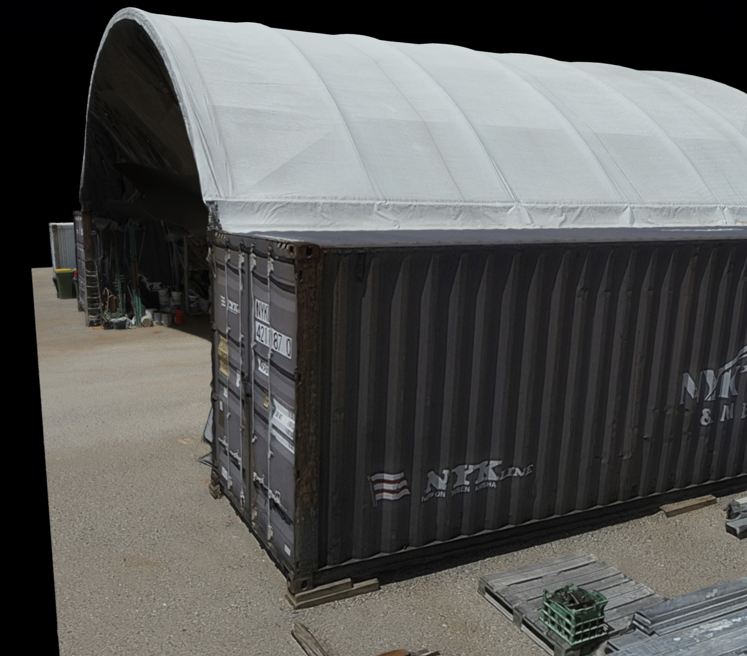
Photogrammetry
Photogrammetry is the science and art of obtaining reliable information about physical objects and the environment through the process of recording, measuring, and interpreting photos.
We use photogrammetry to produce high resolution orthophotos, providing important temporal and spatial information. Clients can confidently identify and trace visible features from the orthophotos to an accuracy similar to measuring physically with GNSS rovers. Accurate contours and stockpile volumes can also be calculated on bare earth and hard-stand sites.
We have completed projects ranging from capturing digital twins of buildings , to capturing 23km long corridor surveys of roads or riparian zones.
With 8 years experience processing photogrammetry, we regularly create maps, drawings, measurements, and 3D surfaces by analyzing and extracting data from aerial photographs.

-
3D Laser Scanning
Terrestrial 3D Laser Scanning captures entire scenes quickly and safely enabling high accuracy measurements from any visible point to another.
We can scan an entire building quickly producing a point cloud that can be used to create as-built floor plans and elevations, enable building modelling to LOD200 and verify dimensions of commercial real estate.
Prevent having to make return visits by capturing the entire site using 3D Laser Scanning.
-
3D Models for Inspection Purposes
Using photogrammetry we can create a Digital Twin of an asset or building for inspection purposes.
Our digital twin 3D models provides a photorealistic model that can be inspected from any device with a web browser. Users can add notes, annotations and view original photos, take measurements and collaborate with others. 3D Models are a powerful tool you can use to communicate your needs with other contractors.
-
Complete Mapping Solution
As a CASA Certified Remote Operator with qualifications and 6 years experience in the Surveying industry, Spatial Awareness Mapping is uniquely positioned to offer the complete mapping solution for your business.
Take the hard work and time consuming processing out of your workflow. Allow us to take care of your mapping needs from start to finish and deliver high quality, professional spatial products when and where you need them.
We work with Surveyors to capture and deliver data in whatever coordinate system you need.
Deliverables:
• Orthophotos
• DEMs / DTMs / DSMs
• Photorealistic 3D Models
• Verified Contours / 3D Mesh
• Point clouds
• 2D CAD Linework
